I woke up early (for me) and, after a breakfast of coffee cake and chocolate milk, left the campsite at 8:00.
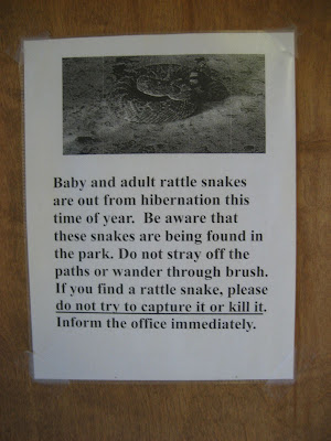
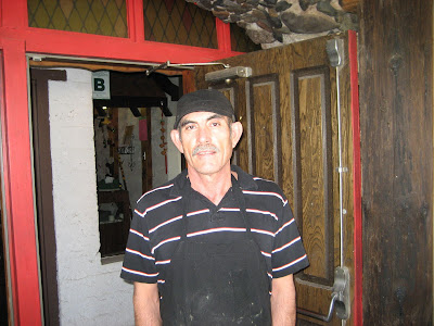
This sign is on the door of the campground's grocery store.
 |
| From mark on a bike 08 |
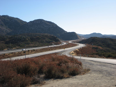
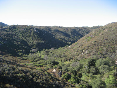
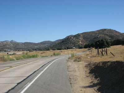
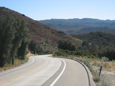
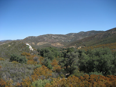
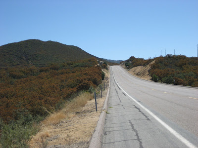
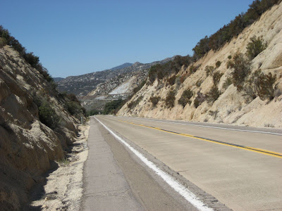
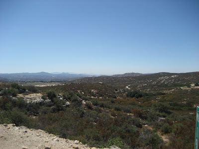
Here are a few other pictures taken along the road.
 |
| From mark on a bike 08 |
 |
| From mark on a bike 08 |
 |
| From mark on a bike 08 |
 |
| From mark on a bike 08 |
 |
| From mark on a bike 08 |
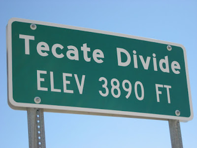
I climbed all morning, a steady and not necessarily unpleasant grinding up the mountain, passing through Pine Valley, over the Tecate Divide, and through Live Oak Springs. I had a headwind the whole way, but it wasn't too bad. Even though the temperature this morning was only in the low- to mid-80's I still drank three water bottles.
 |
| From mark on a bike 08 |
 |
| From mark on a bike 08 |
 |
| From mark on a bike 08 |
 |
| From mark on a bike 08 |
In Boulevard (pop. 415) I stopped at the Salsa Lynda Cafe and ordered huevos rancheros. At the opposite end of the spectrum from Ramona's, these huevos rancheros were ranked as second best (and possibly the best) I've ever eaten.
The owner/cook, Armando, noticed the empty water bottles on my table and offered to fill them for me with "the best well water in the area. It's still got all the minerals in it," he proudly announced. "Very sweet."
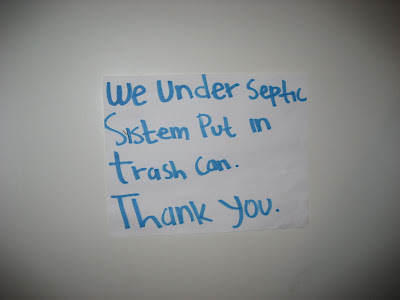
The sign in the bathroom read:
 |
| From mark on a bike 08 |
I haven't figured out the meaning yet, and I'm sort of afraid to.
Armando and I chatted a while longer and I learned that he makes 18 different kinds of salsa. The salsa for the huevos rancheros, for example, is different from the salsa for the dip. Not bad for a guy who used to be a construction worker, a cement worker, a roofer, and a few other things before opening a cafe. And the water WAS sweet.
 |
| From mark on a bike 08 |
Leaving Boulevard I had a brief climb, then coasted into Jacumba (pop. 400). Jacumba is less than half a mile from the Mexican border. Out of the first ten vehicles that passed only one wasn't Border Patrol. Off to my right you could see a huge fence going up. Even without the huge barricade I don't see how something even as small as a chihuahua could get past.
|
| From mark on a bike 08 |
I kept hearing noises that sounded like gunshots but it was probably just noise from the construction and my overactive imagination. Probably.
From Jacumba I had another brief climb, then plummeted almost 3000 feet into the valley below. For this section, because there IS no other way, bicyclists travel on Interstate-8 along with 18-wheelers and RVs. The shoulder is very wide, though there is a lot of debris. As long as I didn't see any debris from bicycles or bicyclists I didn't get too worried.
The temperature began to rise dramatically during the descent.
Ocotillo is my "point of no return." If I keep going, I need to make it all the way to El Centro - there's nothing in between but twenty miles of heat. When I arrived it was a few minutes before 5:00.
I did some quick calculations... 20 miles to El Centro at a pace of 10 mph (slow enough to ensure I don't overheat)... that would put me there right around 7:00 when it's dark. That's doable.
I stopped at the bar/grocery store in Ocotillo just long enough to refill my water bottles and answer a few Frequently Asked Questions. On my way out I asked the cashier how far it was to El Centro.
The problem with quick calculations is that you sometimes leave out an important element - like accuracy. Three minutes later it registered, "Did he say THIRTY miles? I think he did."
Okay, so I'm a little slow. According to my quick calculations, now I actually have to ride fifteen mph. On a loaded touring bike.
My ACA map said this section of the road is rough. When it's bad enough for them to warn you, it's going to be REALLY bad.
 |
| From mark on a bike 08 |
So I actually have to ride fifteen mph. On a loaded touring bike. Over a road that makes my handlebars feel like a jackhammer.
The heat is oppressive. That sounds so trite, but it it was horrifically hot and I could feel my core temperature rising.
So I actually have to ride fifteen mph. On a loaded touring bike. Over a road that makes my handlebars feel like a jackhammer. In the heat.
Oh, and factual tidbit from the slow guy on a bike: as darkness was descending, I realized that being on the EAST side of a mountain range causes it to get darker earlier.
Which means... I was having to ride fifteen mph. On a loaded touring bike. Over a road that makes my handlebars feel like a jackhammer. In the heat. In the dark.
Could it get worse? Yes, but I'll stop adding to the list.
I went through Plaster City, which isn't really a city. It's just a giant manufacturing plant... of plastic, I presume.
About a third of the way between Ocotillo and El Centro, tooling along at a pace which would hopefully balance my time constraints and my rising core temperature, I realized that the scale was tipping.... I was overheating. Even at a pace well below 15mph I was still getting too hot. After thinking about it for a minute, I considered taking off my helmet. I read that a person loses 40% of their body heat from the head and neck areas so I wondered whether, in spite of my helmet's advertising claim of having "SIXTEEN MASSIVE AIR SUCKING VENTS," I might be cooler if I rode without it. What would be safer? Riding with it or riding without it?
Okay kids, remember: SAFETY FIRST! Don't wear your helmet!
Looking back, I'm kind of glad that statistic said "head and neck" instead of "groin and butt."
Just past Plaster City the elevation dropped below sea level. I'm now in the Mojave Desert, and it's over a hundred degrees even at dusk. I drank three liters of water before lunch and four liters of water after lunch, plus one liter of Gatorade. Even so, I didn't urinate a single time all day. Not that you want to hear about my urinary habits - it's just to say I was pretty dehydrated.
I have a small battery-powered red flashing light which I clipped onto the back of my bike as dusk descended.
I arrived in El Centro after dark and checked into a motel. It was much too hot to camp, and besides, the nearest campground is five miles off my route.
I was EXUDING heat, and even a cold shower only helped a little.
Too tired to go out for supper, I ordered a pizza delivered to my room. They didn't accept traveler's checks so I used my last bit of cash. I'll need to get some more cash tomorrow.
Just like during last year's trip, my right index fingertip has gone numb.
Shortly before going to bed I looked at the map and my heart sank. Brawley is fourteen miles down the road. There's a small note on the map, which I should've seen earlier, that says, "SERVICES ARE EXTREMELY LIMITED BETWEEN BRAWLEY AND PALO VERDE. PLAN ACCORDINGLY AND CARRY FOOD AND WATER."
Palo Verde is 84 miles from here. That means, unless I camp on the side of the road in the heat, I'll need to ride either 14 or 84 miles. Today's ride, half of which was through temperatures below 90 degrees, just about wiped me out. I really don't know if I can make it.
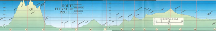
88.177 distance
34 max speed
11.4 average
7:43:00 time
120.68 cumulative

2 comments:
Scary day, Mark! And that's so wierd about your finger. Good luck tomorrow!!!
Hi Mark! Sounds like you are having some fun! Can't wait to read the next entry! Keep the helmet on...or, I'll tell mom! :-)
Post a Comment